← All Ultimate Hikes Ultimate Hikes

Cangshan Day Hike

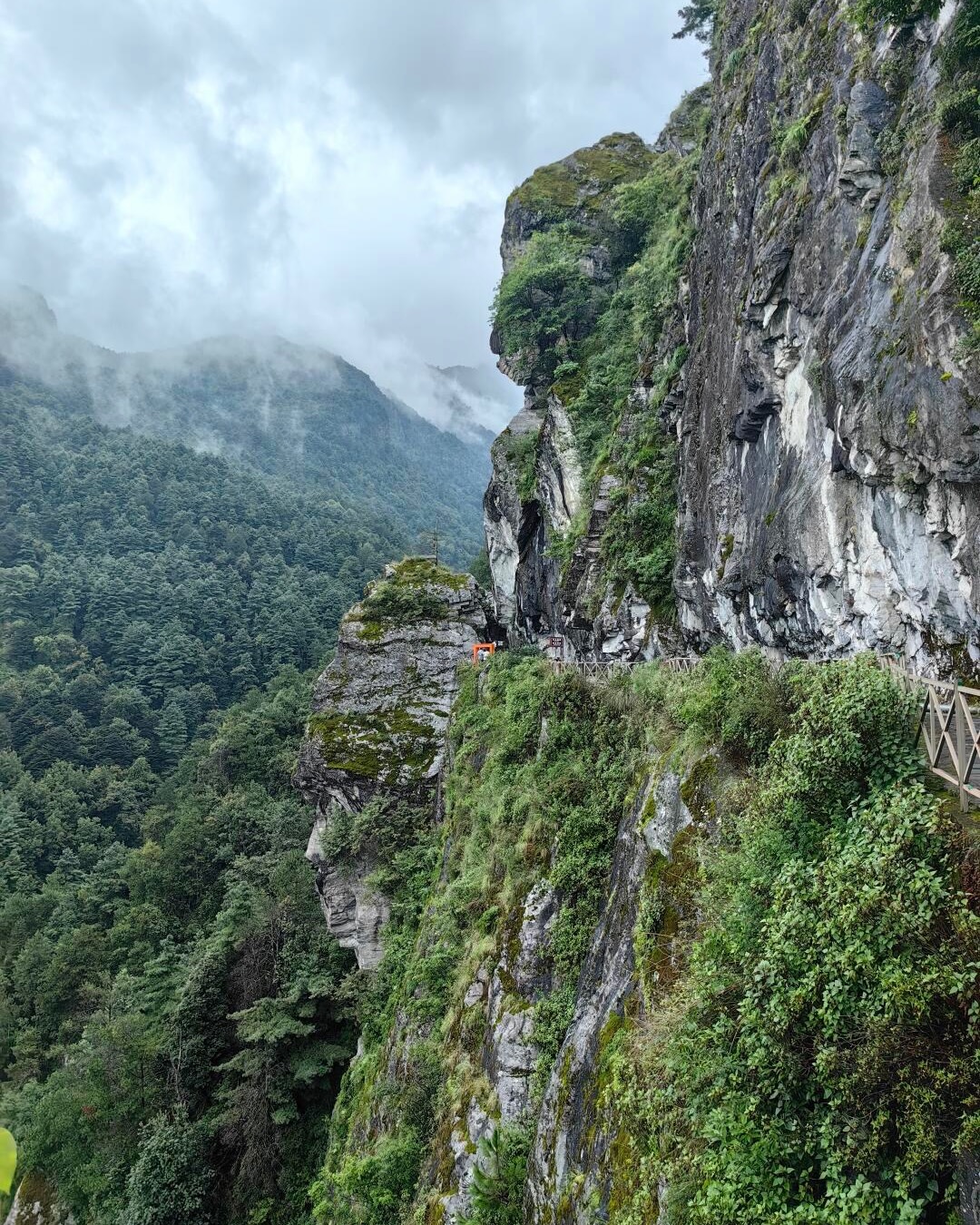
The Jade Belt Cloud Path — 11.5 km of near-level ridge walking with Erhai a kilometre below

1 day easy 2,600 m max Mar, Apr, May, Sep, Oct, Nov

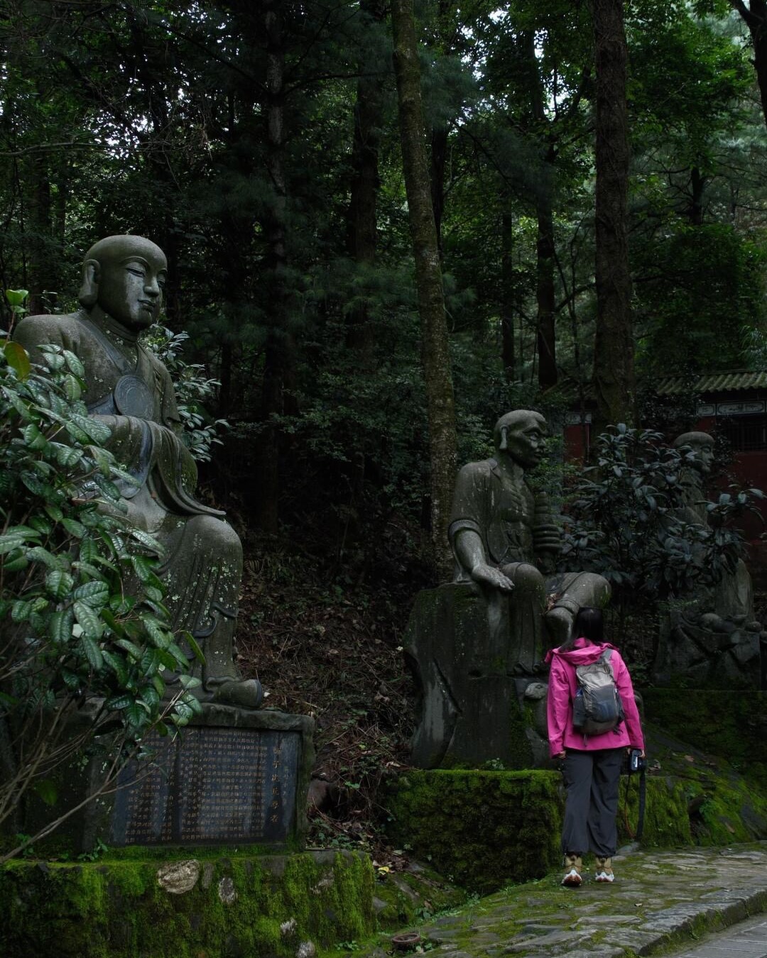
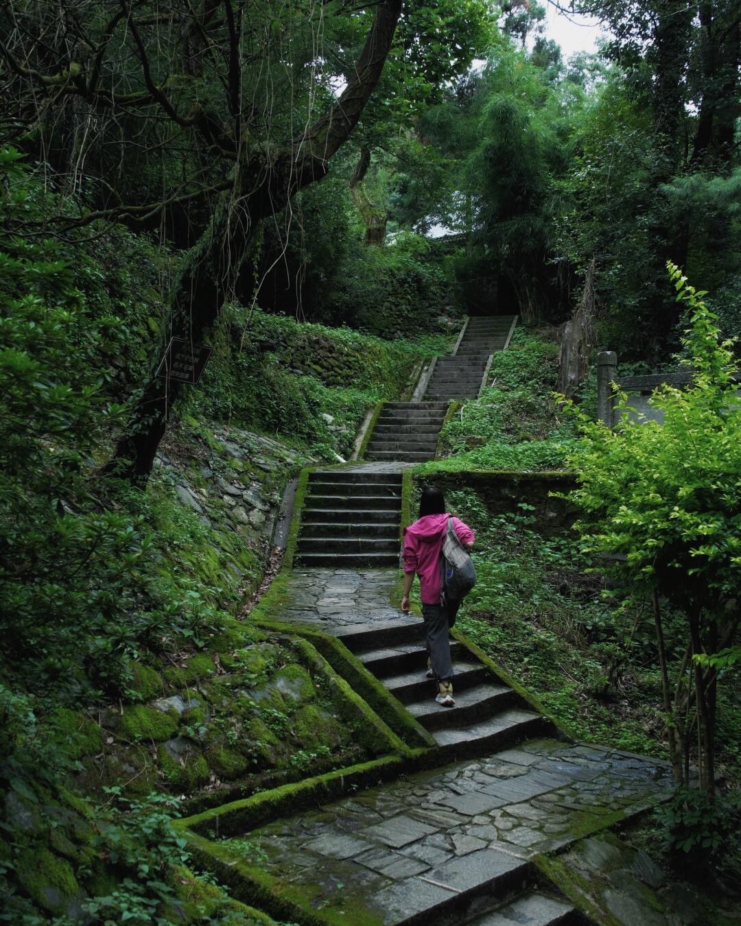
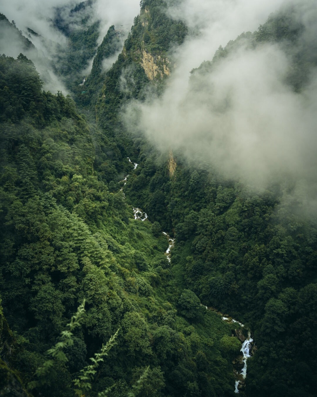
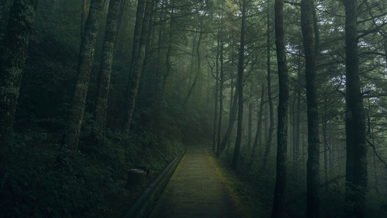
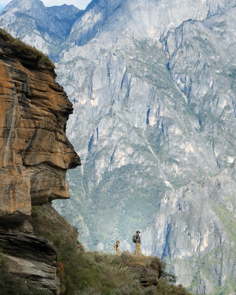
Cangshan's Jade Belt Cloud Path (玉带云游路) is the alpine-view-without-alpine-effort walk above Dali. A near-level paved track cut into the mountain's 2,600 m contour, eighteen kilometres in full or eleven and a half in the standard Gantong-to-Zhonghe day section, with Erhai Lake spread a kilometre below for the entire distance. We ride the Gantong cable car up out of the foothills, step onto the path near Zhonghe Temple, and walk west through stone-cut gorges where streams slice down to the lake. Pines, alpine meadow flowers, the occasional Bai pilgrim. Eleven and a half kilometres later we drop down on the Zhonghe cableway and are back in Dali Old Town for dinner. The easiest entry-point into the Ultimate Hikes section — a counterweight to Meili and Yubeng for travellers who want the view, not the suffering.

Ask about this experience
Cliffside trail of the Jade Belt Cloud Path near Gantong Temple on Cangshan, with Erhai Lake far below — hero image for the Cangshan Day Hike by Boutique China
At a glance

The experience

  • RouteGantong cable car up → Jade Belt Cloud Path traverse → Zhonghe cable car down (or reverse, same effect)
  • Distance~11.5 km Gantong-to-Zhonghe section, the standard day walk; 5–6 hrs walking with lunch + photo stops
  • Altitude~2,600 m throughout — near-level paved walkway, no significant elevation gain on the path itself
  • Easy difficulty — the altitude is the only factor; pace, not gradient, is the limiter
  • Optional add-onXimatan Cableway up to ~4,000 m for a separate snow-zone summit moment (extra ~3 hrs)

Why the Jade Belt Cloud Path

  • It is the rare alpine walk that almost anyone walking-fit can do. A continuous paved path along the 2,600 m contour means no scrambling, no exposed sections, no fitness barrier beyond reasonable cardio. The view is the same view you get from a serious trekker's day at this altitude.
  • The 'jade cloud' — a thin cloud band that hugs the contour like a belt — appears most often in late summer and early autumn. On a good day you walk through it at eye level.
  • Compared to Meili / Yubeng / Niruthis is the easy entry-point. For travellers who want to add 'a real mountain day' to a Dali stay without committing to multi-day trekking, the Jade Belt is the right choice. We pair it often with a Dali boutique hot-spring stay either side.

The day plan

  • 0830 — short drive from your Dali hotel to the Gantong cable car base station. Tickets purchased in advance (we handle).
  • 0900 — Gantong cable car up out of the foothills. Quick ride; arrive top station near Zhonghe Temple at ~2,600 m.
  • 0930 — step onto the Jade Belt Cloud Path. Walking westward, following the mountain contour. Pines, alpine meadow flowers, deep stream gorges (Qingbi Stream is the signature one) cutting down to Erhai. Photo stops at the named gorges + overlook points.
  • 1230 — picnic lunch at one of the wooden gazebos along the path — packed lunch provided by your guide.
  • 1430 — reach Zhonghe Temple at the western end. Tea and a short visit before descending.
  • 1500 — Zhonghe cableway down. Back at base station by 15:30.
  • Eveninghot-spring soak at one of the Dali boutiques, or a Bai-courtyard dinner in Xizhou.

Optional add-on — Ximatan Cableway to 4,000 m

  • If you want a separate snow-zone summit moment after the Jade Belt, the Ximatan Cableway (5,555 m long, China's longest tourist cableway) climbs from ~2,000 m to ~3,920–4,000 m on the upper Cangshan ridge.
  • Top of Ximatanrhododendron meadows in May–June, residual snow into early summer, panoramic views back across Erhai. A short walkable boardwalk loop at the top — not a hike, more a viewpoint stop.
  • Best added either as the morning of a Cangshan day (before the Jade Belt) OR as a separate half-day. Adds ~3 hrs to the day overall.
  • Acclimatisationif you're going from Dali (1,900 m) direct to 4,000 m on the same day, take it slowly at the top, no running for the cable car, no alcohol the night before.

Hotel Selection

  • Pushanbamboo-and-timber forest hot-spring retreat above Eryuan — the wellness-first reset for the night before or after the Cangshan day.
  • The Dawn Hotel (SLH)contemporary lakeside hideaway under Cang Mountain — the closest design-forward base to the cable car stations.
  • Mingyue SongjianErhai-lakeside 'art space' boutique in Shuanglang — if you want the lake view from the room after a ridge-view day.
  • Muxi Huoshanlake-view boutique on the Erhai east shore — another option for the post-hike evening.
Practical details
  • Fitness baselinewalking-fit. The path is near-level; what tires you is the distance (~11.5 km) and the thin air (2,600 m). If you can walk 4 hours at a reasonable pace on a flat path at home, you can do this with our pacing.
  • Altitude2,600 m. Dali itself sits at ~1,900 m so you've already had passive acclimatisation by the time you reach the path. Most travellers feel nothing on the day; a small minority notice mild head-pressure that settles in 30 minutes.
  • Gearcomfortable walking shoes (sneakers are fine — this isn't trekking), light layers (a thin fleece + light rain shell), sun hat, sunscreen. Standard day walk kit; no specialist equipment.
  • Permit + guidestandard Cangshan scenic-area ticket plus cable car fares — handled in advance. A local guide is optional but adds value for the orientation, the temple history, and lunch logistics; bundled into our trip price.
  • Best windowsMarch–May and September–November. Late spring brings the high-altitude rhododendrons; autumn brings the clearest Erhai views. May–early June for the upper-Ximatan rhododendrons. The 'jade cloud' band is most reliable in late summer / early autumn.
  • Pricingfrom AUD $300 pp twin-share for the day — includes private vehicle, local guide, scenic-area + cable car tickets, lunch on trail. Ximatan Cableway add-on ~+$60 pp. Excludes Dali accommodation.
Common questions

Before you book

01 Is the Jade Belt actually a hike?

It is a walk on a paved path along a mountain contour, with significant distance (11.5 km) but no real elevation gain. Yunnan locals call it 徒步 (hiking); some serious trekkers might call it a long walk. The reality is it gives you the alpine-view payoff of a real hike without the climbing. We list it under Ultimate Hikes because it belongs in any conversation about walking the mountains of Yunnan — it's the easy entry-point alongside the harder treks.

02 When are the rhododendrons in bloom on the Jade Belt?

The path itself runs at 2,600 m, which is below the densest rhododendron zone. You'll see some flowering trees in April–May along the way, but the show-stopping rhododendron meadows are higher up — at ~3,500–4,000 m, accessed via the Ximatan Cableway. If rhododendrons are the goal, May–early June and the Ximatan add-on is the combination.

03 Can I do this as a half-day instead?

Yes. The cable cars at both ends let you walk a shorter section (say, 5–6 km / 2–3 hrs) and ride the cable car down from the same end you came up. A half-day Jade Belt is a strong option if you want one mountain morning + a Dali afternoon for tea-house culture or Xizhou markets. Talk to us about combining.

04 How does the Jade Belt fit into a longer Yunnan trip?

Naturally and early. Dali is usually the first or second stop in a longer Yunnan itinerary, and the Jade Belt makes a strong Day 2 or Day 3 — your body's still adjusting to mild altitude (~2,000 m) and a long-but-easy mountain walk is a perfect pace-setter for harder trekking later in the trip. Standard sequencing: Kunming → Dali (2 nights with Jade Belt) → Lijiang → Shangri-La → Yubeng / Meili.

Ready to Plan Your Journey?

Contact Us