Most China travel guides stop at Chengdu, maybe Jiuzhaigou. West Sichuan — the real West Sichuan — extends for another thousand kilometres beyond that. Two enormous prefectures. Snow peaks above 7,000 metres. Alpine lakes that look like someone dissolved gemstones into the water. Tibetan monasteries so remote that the monks have lived there for generations without anyone passing through. And a network of scenic drives through Ganzi that most Australian travellers have never heard of — where the road itself is the experience.
This is the guide that other guides don’t write. Not because the information doesn’t exist, but because most people covering West Sichuan have never actually driven or lived in there.
Here’s what you need to know to help you start looking at a West Sichuan trip.
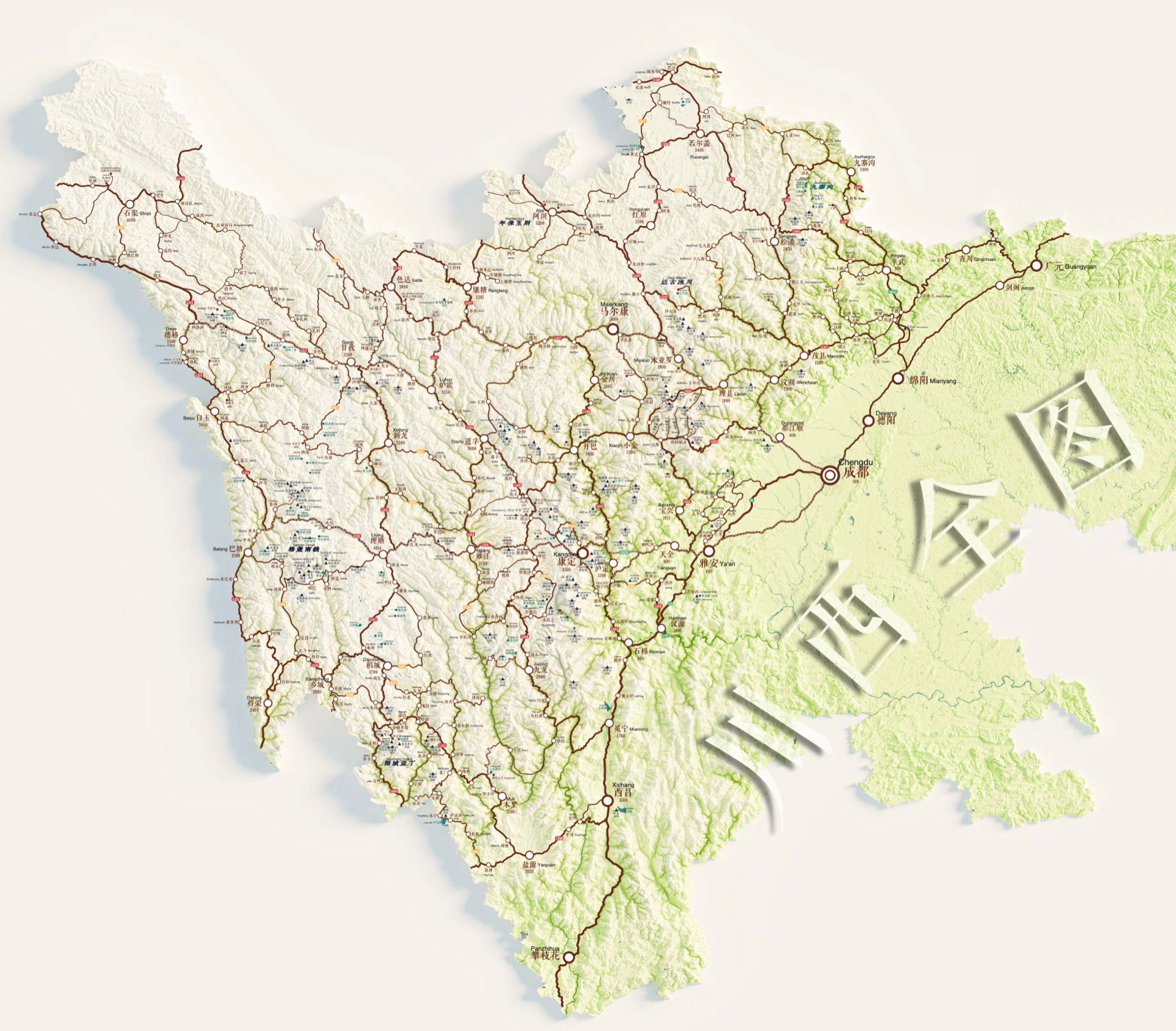
Two Prefectures, One Region
West Sichuan divides into two distinct administrative areas, and understanding the difference matters before you plan anything.
阿坝州 (Aba Prefecture) covers the northwest. It’s the more accessible half — Jiuzhaigou is here, as is Huanglong, and this is where most itineraries begin and end. Altitudes range from around 2,000 to 4,500 metres.
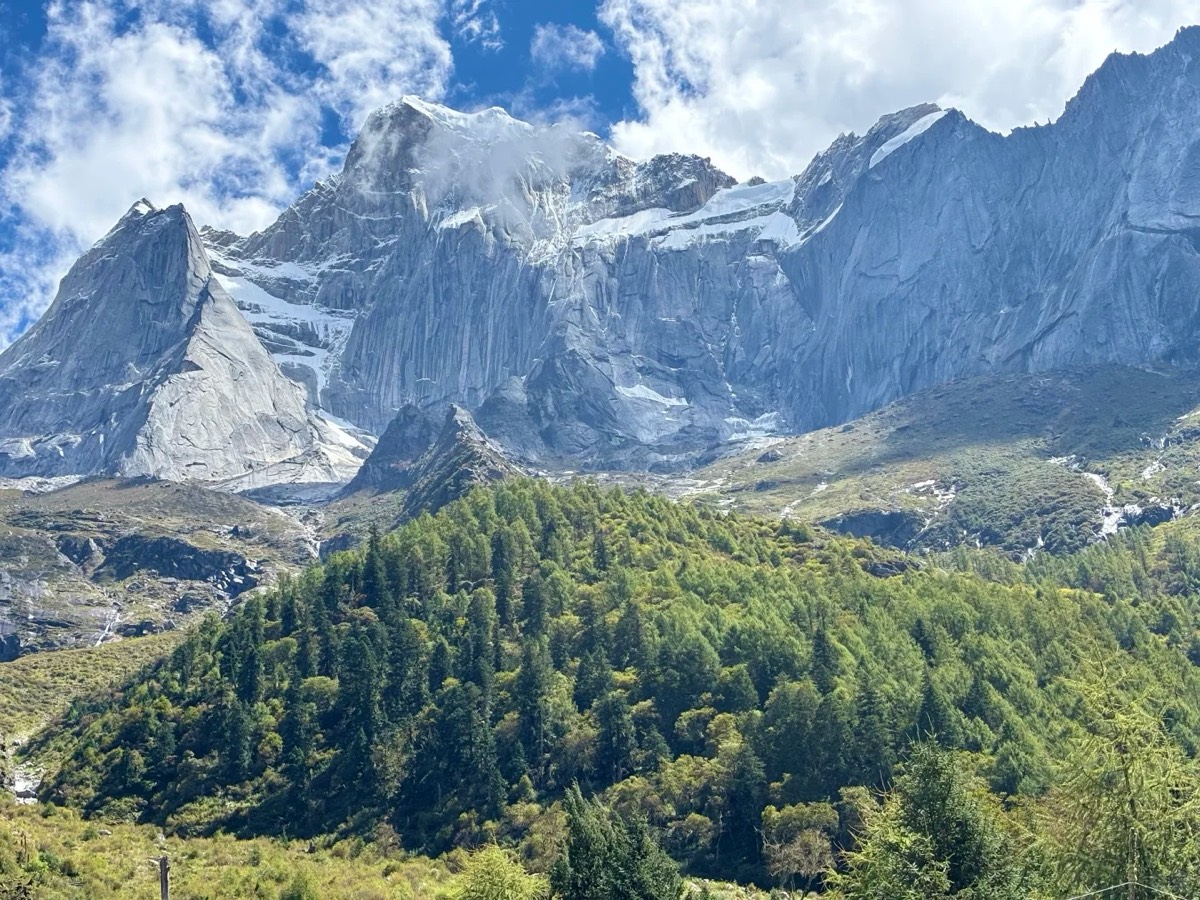
甘孜州 (Ganzi Prefecture) covers the west and southwest, sharing a border with Tibet. It is vastly larger, far less visited, and in our view the more spectacular of the two. This is where the Sky Road runs, where Daocheng Yading sits, and where places like Genie and Gongga are known almost exclusively to serious travellers and photographers. Altitudes are higher — many sites sit above 4,000 metres — and the logistics are more complex.
The two can be combined into one great trip. Allow 18 days minimum to do both properly.
Aba Prefecture — The Northwest
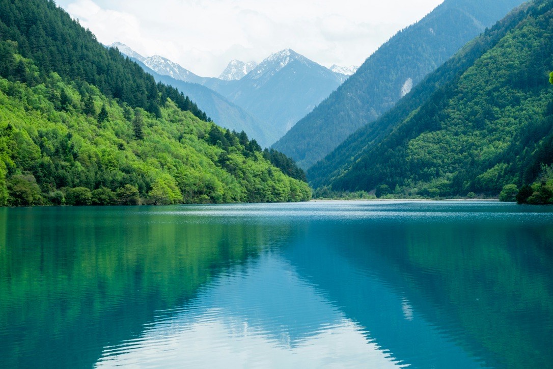
Jiuzhaigou Valley (九寨沟)
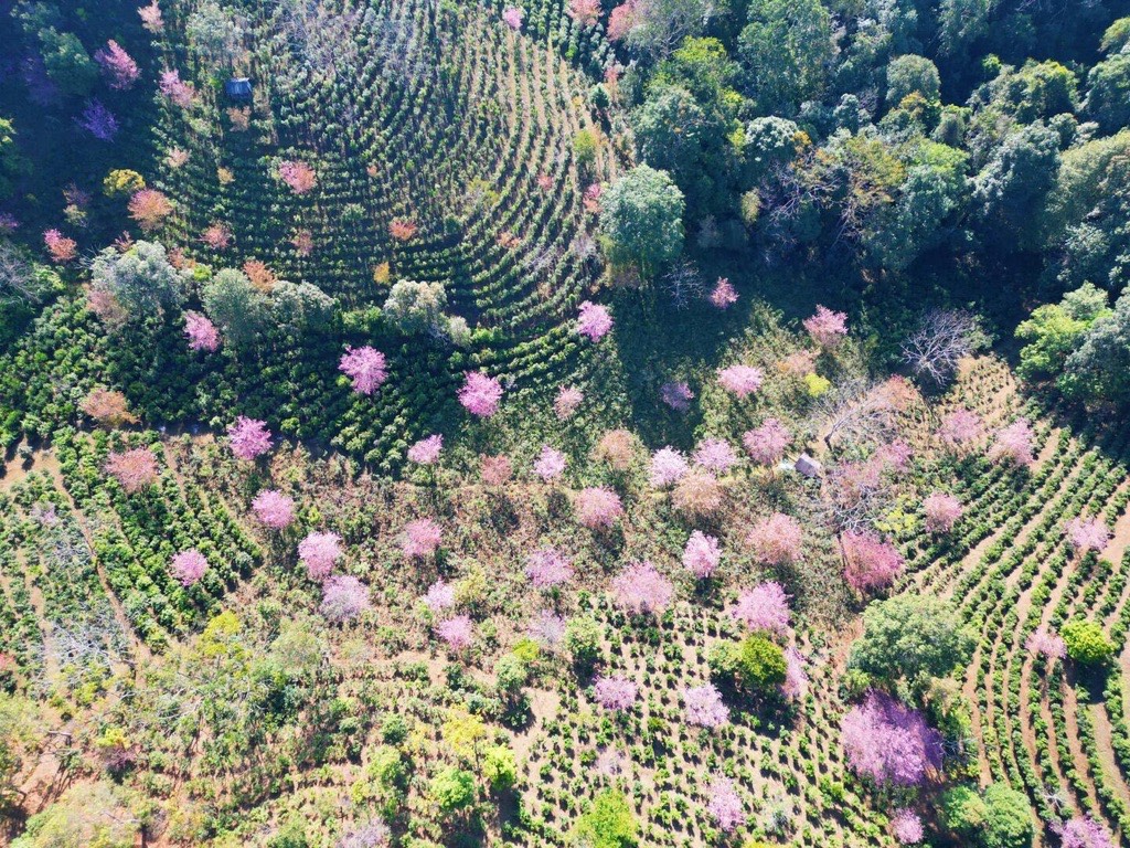
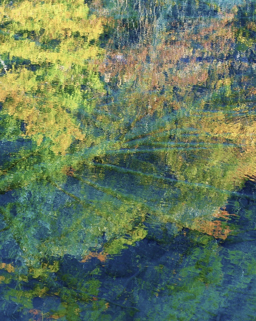
Jiuzhaigou is the reason most travellers first hear about West Sichuan, and it earns every bit of the attention. A UNESCO World Heritage Site in the Min mountains, it contains some of the most extraordinary water on earth: turquoise, teal, and deep jade lakes stacked in a series of valleys, fed by glacial springs, separated by calcified waterfalls that carry the water downhill in curtains of white. The colour comes from the mineral content of the water combined with specific algae and light conditions — and it changes completely with the seasons.
Autumn (late September to early-November) is the peak: the surrounding forest turns gold and red, and the contrast against the lakes is unlike anything else in China. Summer is lush and green. Winter brings snow, which transforms the whole valley and dramatically reduces the crowds — though some areas close for maintenance.
The valley was significantly damaged in a 2017 earthquake and has reopened progressively since 2019. In 2026 it operates with a daily visitor permit cap — this matters for planning, particularly in peak autumn. Book well ahead.
Best time: Late September to early November (autumn) and early Summer (late May to September)
Altitude: ~2,000–3,100m
From Chengdu: ~9 hours by road, or ~2 hours by train followed by 2 hours drive or 40 minutes by flight to Jiuzhaigou Huanglong Airport

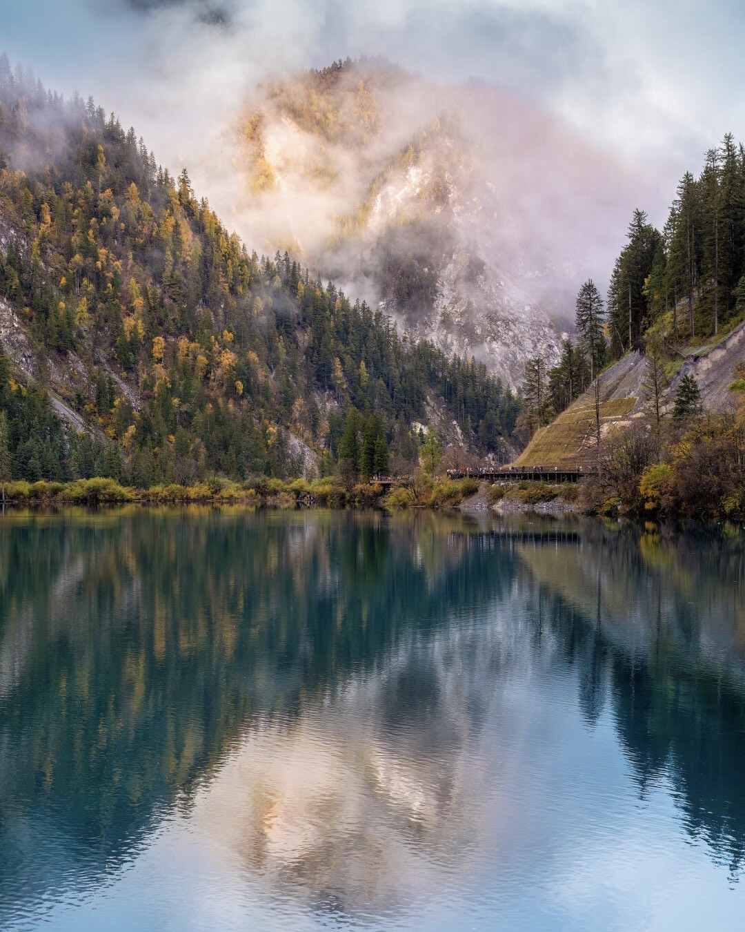
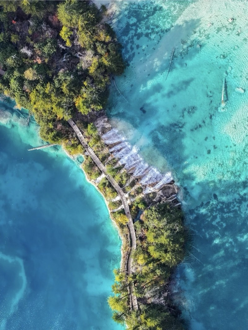
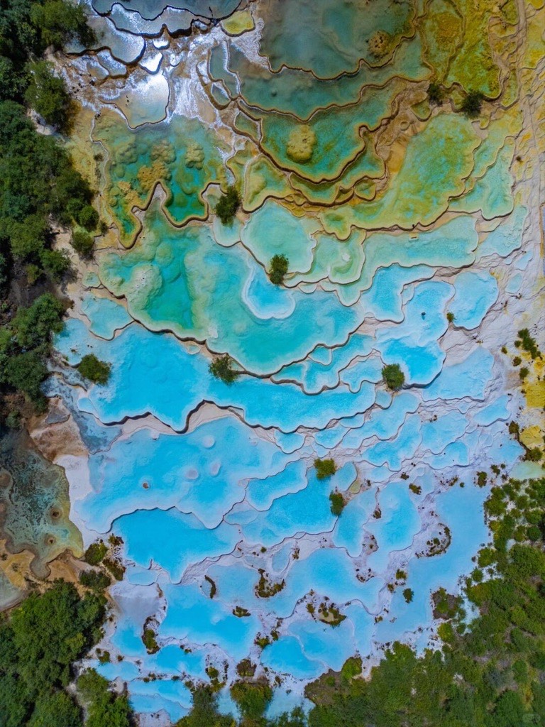
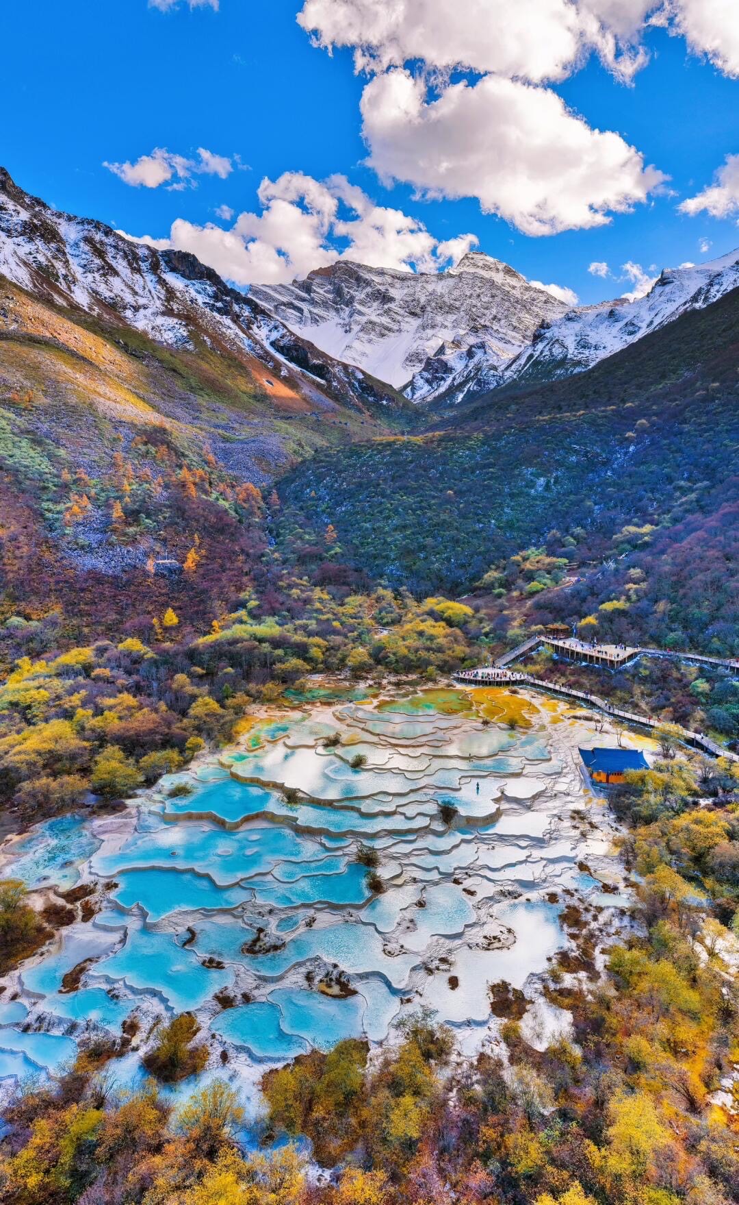
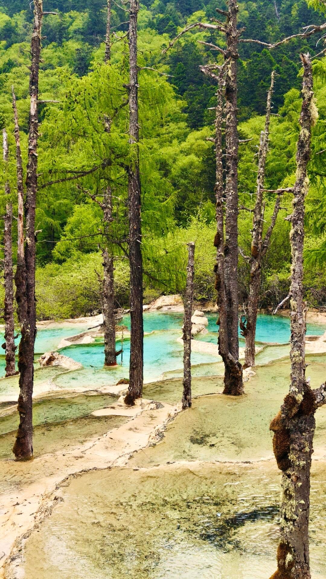
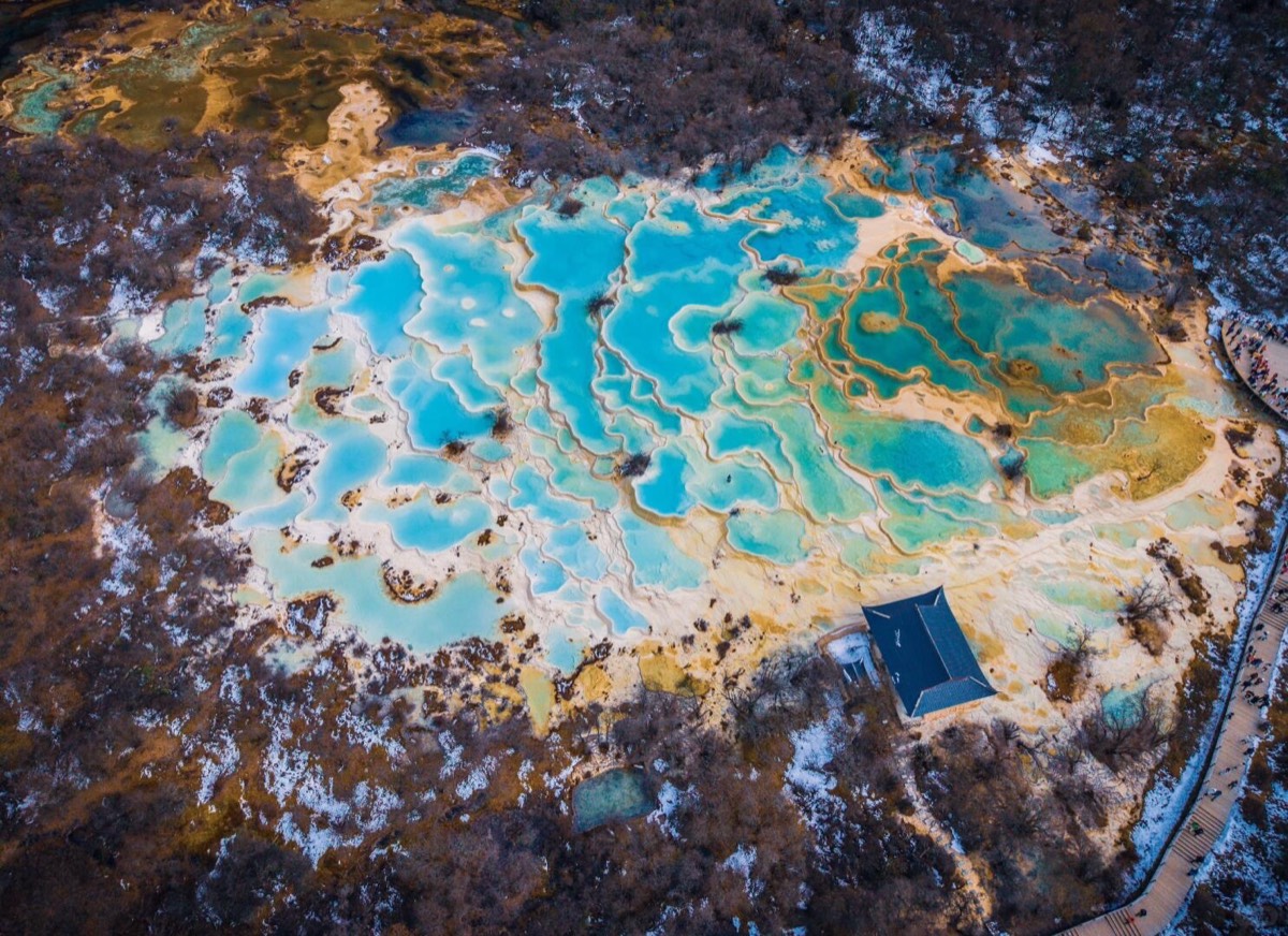
Huanglong (黄龙)
An hour’s drive from the Jiuzhaigou area, Huanglong is a glacial valley whose calcified terraced pools have turned the entire floor golden-yellow — a landscape so strange it looks assembled rather than natural. It’s a UNESCO site, sees a fraction of Jiuzhaigou’s visitors, and the altitude at the upper end (around 3,600 metres) means you’ll feel it on the walk up. The path is wooden boardwalk — straightforward, but slow at altitude.
The combination of Jiuzhaigou and Huanglong over 3–4 days is the most logical route through Aba Prefecture.
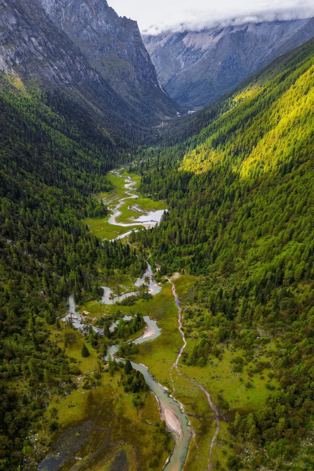
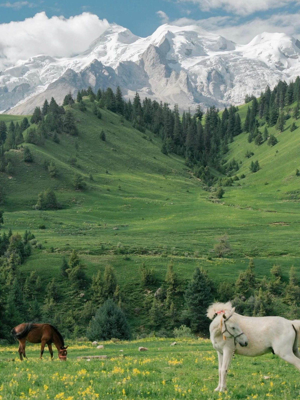
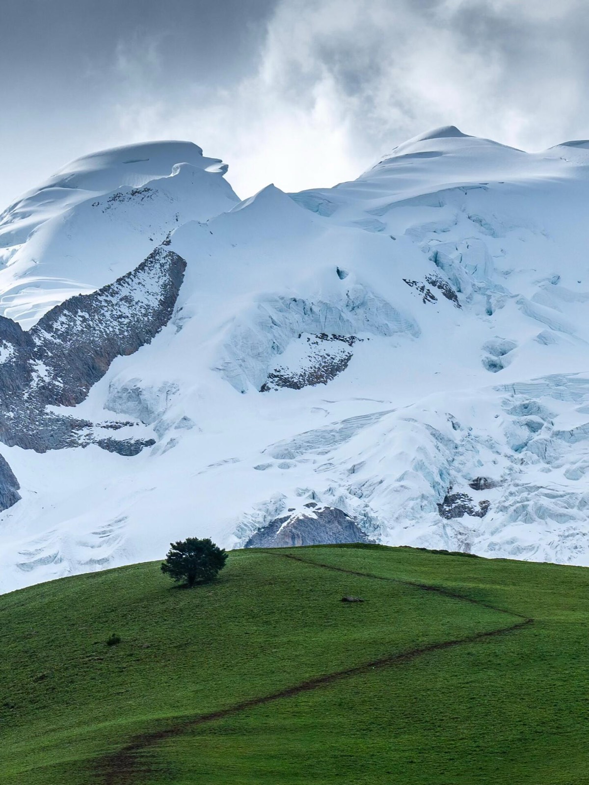
Siguniang Mountain & Bipenggou (四姑娘山 & 毕棚沟)
Siguniang — the Four Girls Mountain — is a row of four peaks rising to 6,250 metres, about four hours west of Chengdu. The surrounding valleys contain excellent hiking trails and extraordinary alpine meadows. Bipenggou, a short drive away, offers a similar landscape: alpine lakes, pine forests, wildflower meadows in late spring and summer, and snow from mid-October onward.
If you have time, do both. If you have to choose, the deciding factor is usually season — Bipenggou is particularly spectacular in autumn, Siguniang for serious hikers year-round. Or don’t choose: the Changping–Bipeng Traverse crosses from Siguniang’s Changping Valley into Bipenggou over the 4,668 m Muluozi Pass — it features on our ultimate hikes list.
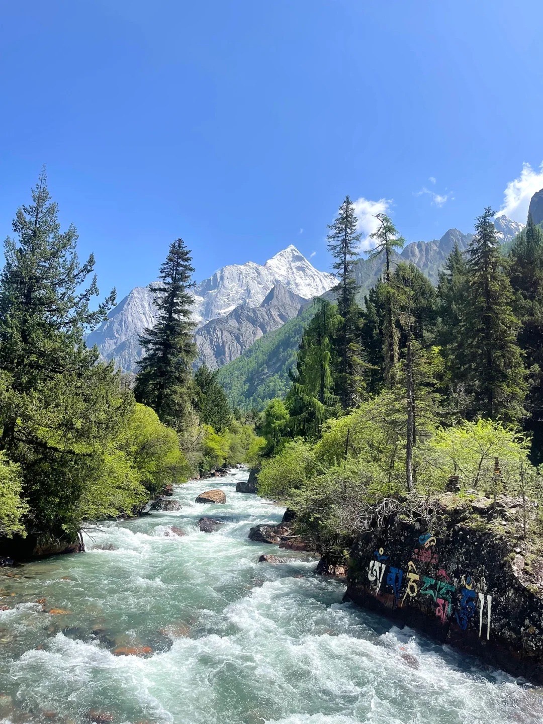
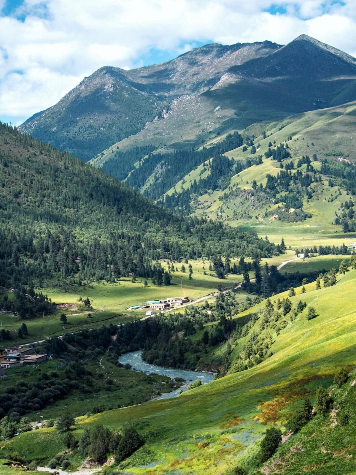
Ganzi Prefecture — The West & Southwest
Ganzi is bigger than many European countries, and every hour you spend driving through it produces scenery that stops the conversation. Most of it is at high altitude, most of it is remote, and most of it has never appeared in an English travel guide. Here’s what matters.
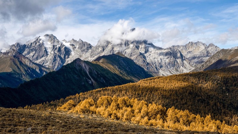
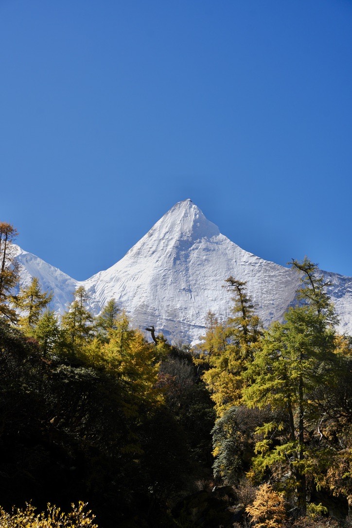
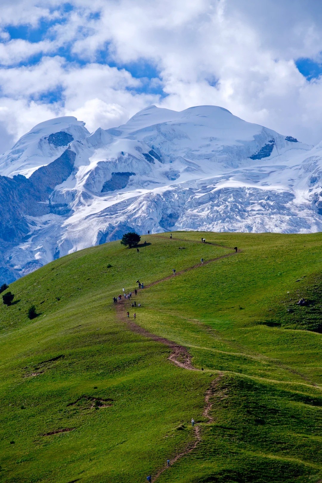
Daocheng Yading (稻城亚丁)
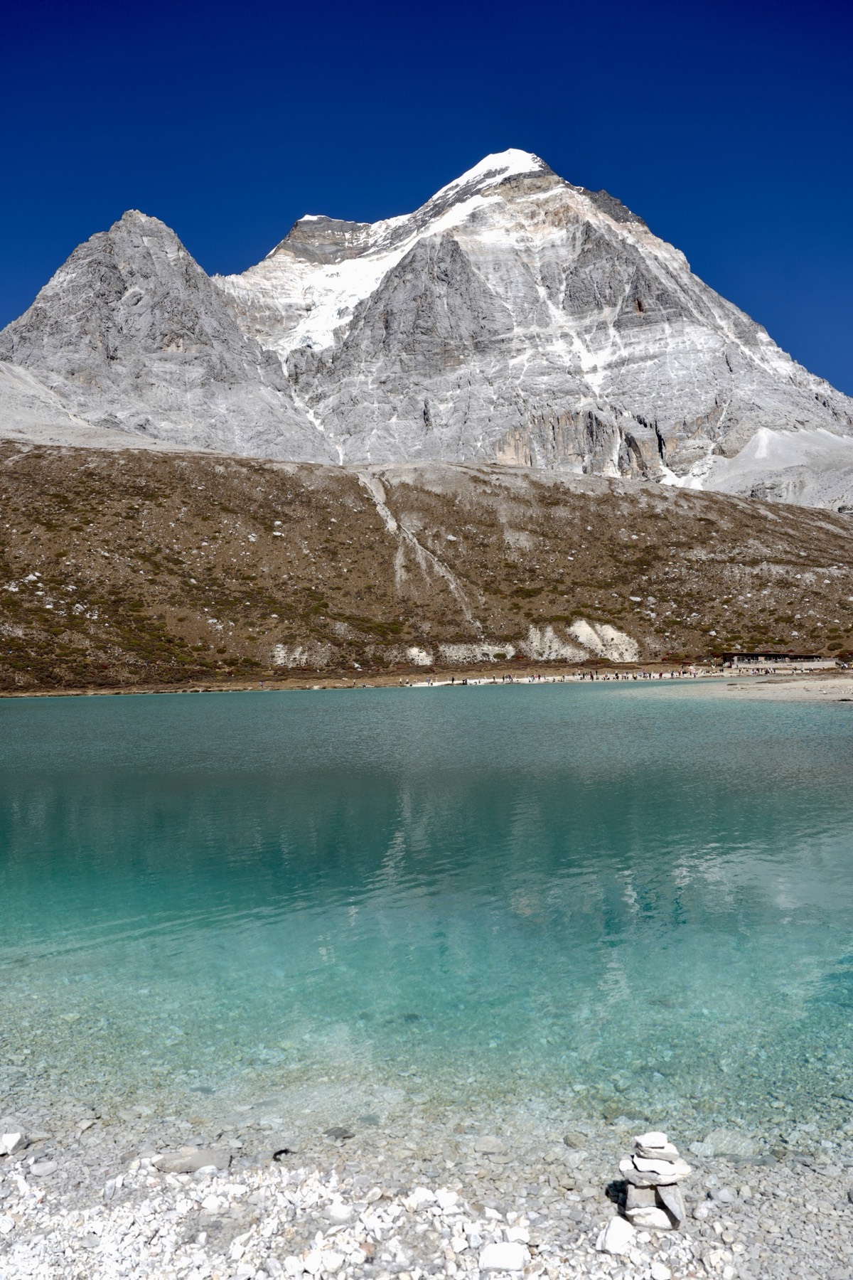
If Jiuzhaigou is West Sichuan’s most famous destination, Daocheng Yading is its most sacred. Three snow peaks — Chenrezig, Jambeyang, and Chanadorje — rise above 6,000 metres and have been worshipped by Tibetan Buddhists for centuries as protector deities. Surrounding them are high-altitude lakes of surreal clarity: Milk Lake (牛奶海) and Five-Color Lake (五色海) sit at around 4,400 and 4,500 metres respectively, and they deliver exactly what the names promise.
The key thing to understand about Yading: it is genuinely high altitude, and reaching the main lakes involves real hiking. Fit travellers walking to Milk Lake should allow 3–4 hours return. Take it seriously — the rewards are extraordinary.
Autumn (late September to Early November) produces red and orange meadows at the base of the snow peaks — the images that made the area famous. Spring (Mid-April to May) brings wildflowers and clearer skies than summer. Parts of the park close in winter.
Daocheng Airport sits at 4,411 metres — the highest-altitude civilian airport in the world. Flying in is fast; your body needs days to adjust. Driving from Chengdu takes 2–3 days (with stops along the road), which is the better option — the gradual elevation gain lets your system adapt, and the route through Ganzi is worth doing on its own terms. [Full guide: Daocheng Yading — Everything You Need to Know Before You Go →]
Best time: Late September to early-November; mid-April to September
Altitude: 2,900–4,500m in the park; 4,411m at Daocheng Airport
From Chengdu: 2–3 days by road (recommended), or ~1 hour by flight
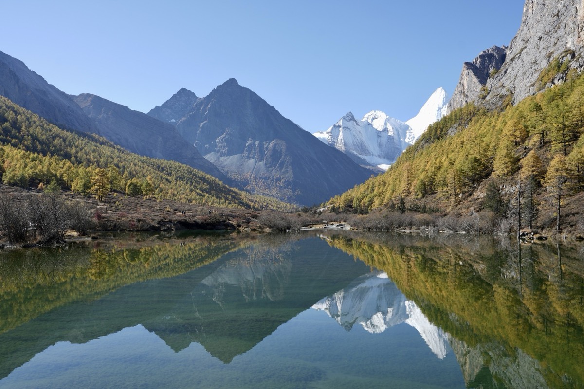
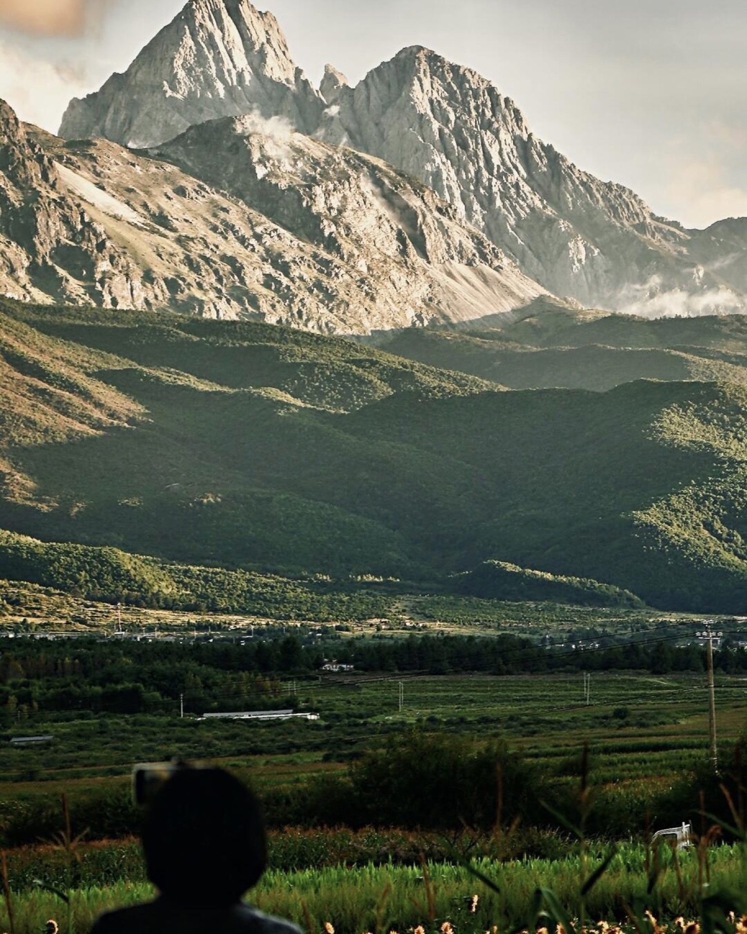
Genie (格聂)
Genie is one of the most spectacular high-altitude landscapes in Sichuan that almost nobody outside the photography and mountaineering community has heard of. The peak rises to 6,204 metres, and the approach valley — a turquoise glacial lake, vast grasslands, and the snow peak reflected in still water — rivals anything in the region.
The road is under construction and expected to finish in June 2026.
There’s no developed tourist infrastructure here. That’s exactly the point. Start with our Genie destination guide — and the Genie South Route, the two-day trek we run through it.
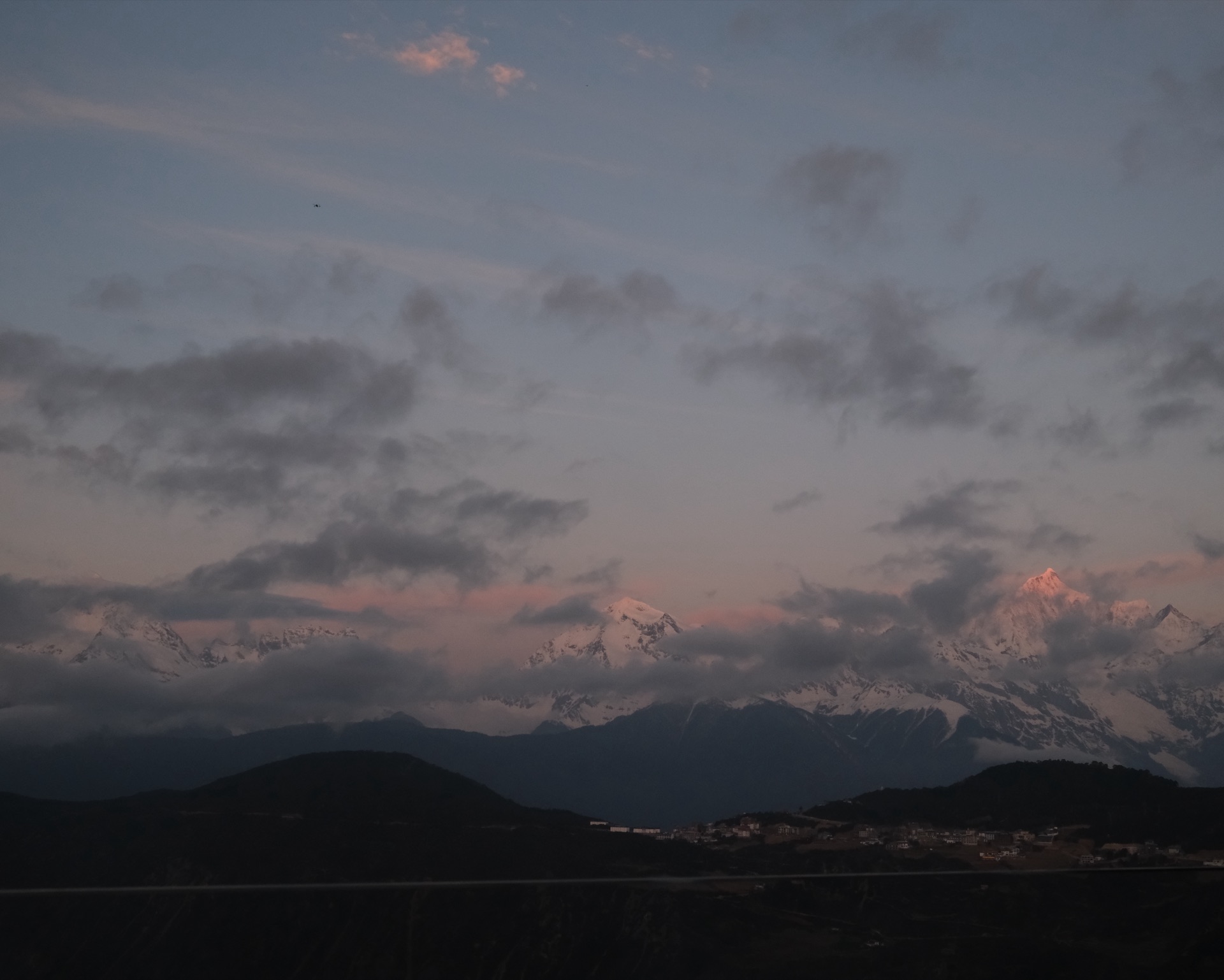
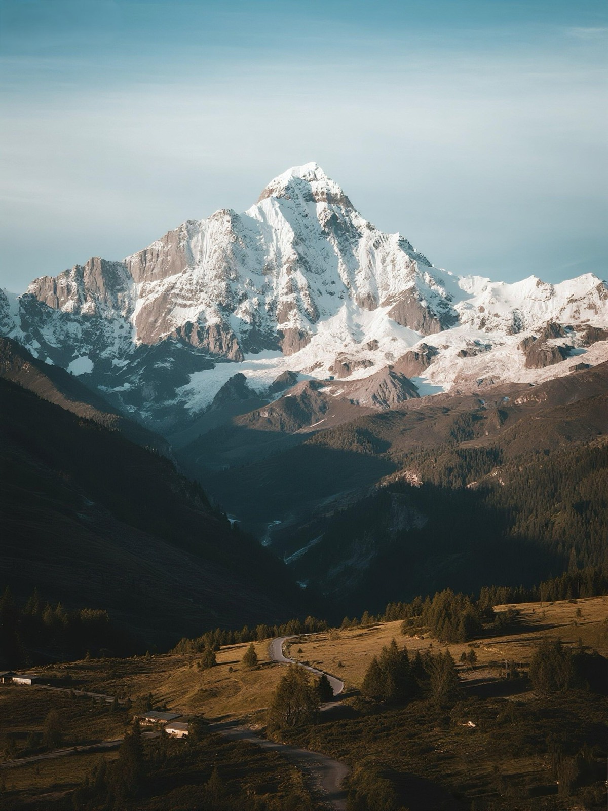
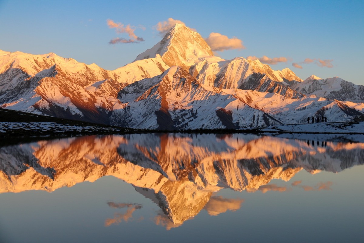
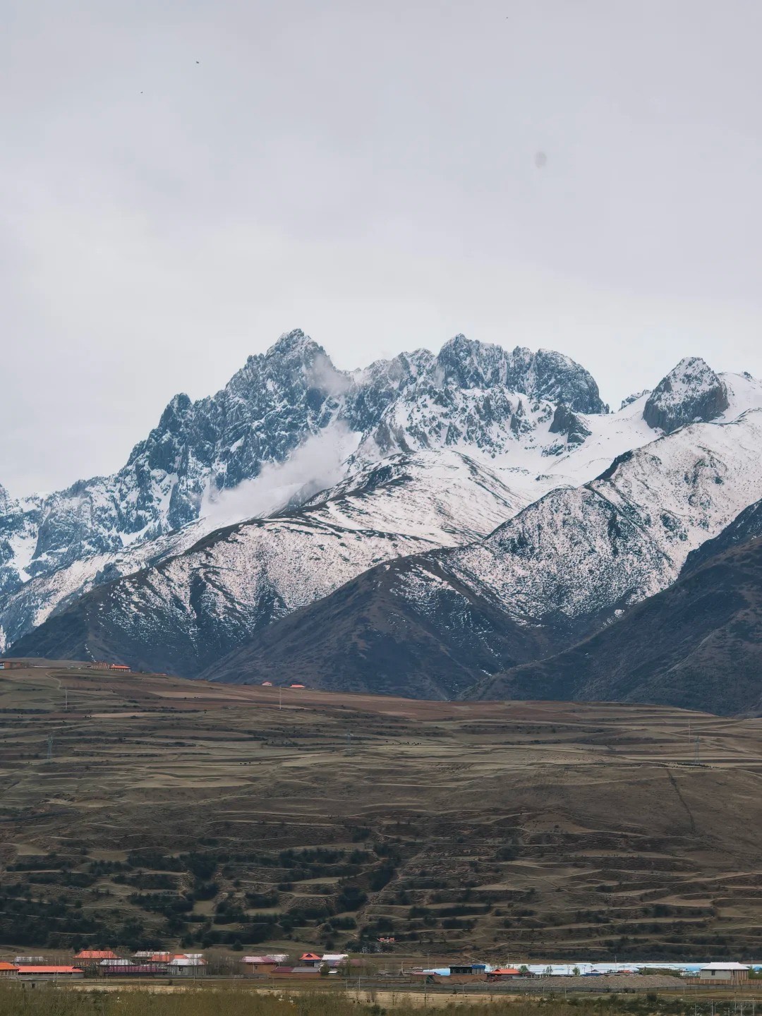
Gongga Snow Mountain (贡嘎雪山)
Gongga is the highest peak in Sichuan at 7,556 metres. At clear moments, it is one of the most imposing sights in Asia — a mass of white that seems too large to belong to the landscape around it. There are many photo spots - the most popular one is Lengga Lake where you get perfect reflection of the snow peak. You can’t summit Gongga without serious mountaineering experience, but the views from the approach roads and lower trails are accessible and extraordinary. Hailuogou glacier sits on its flanks.
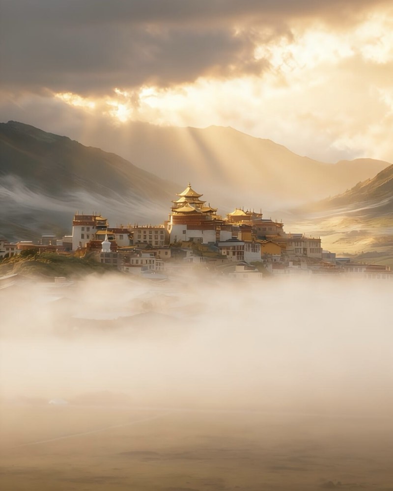
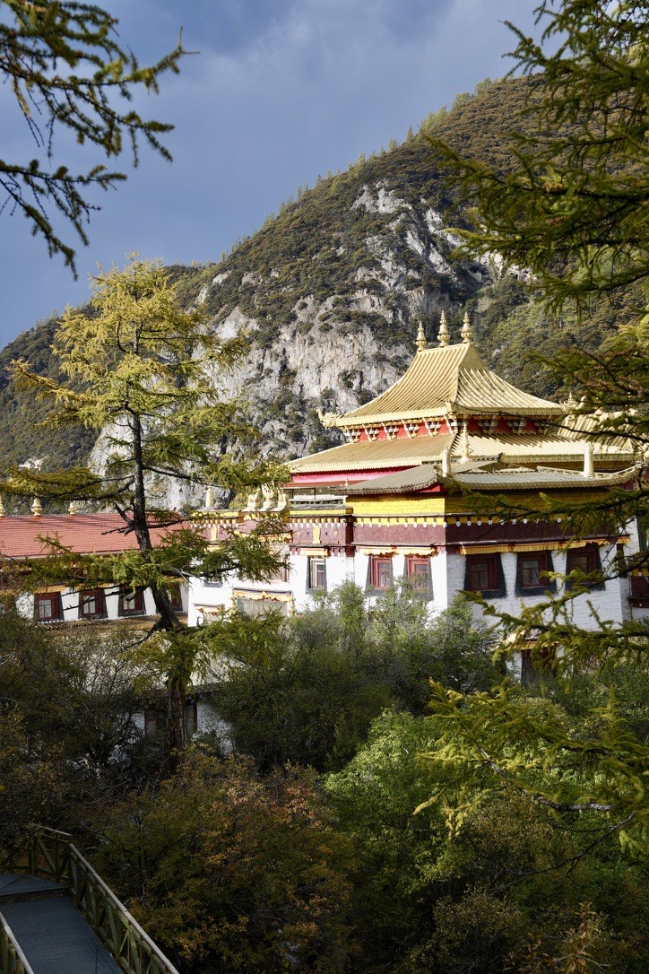
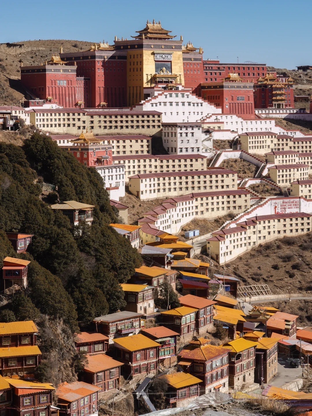
The Tibetan Monasteries: Sertar, Yaqing & Beyond
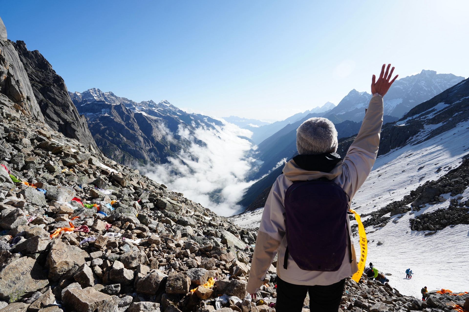
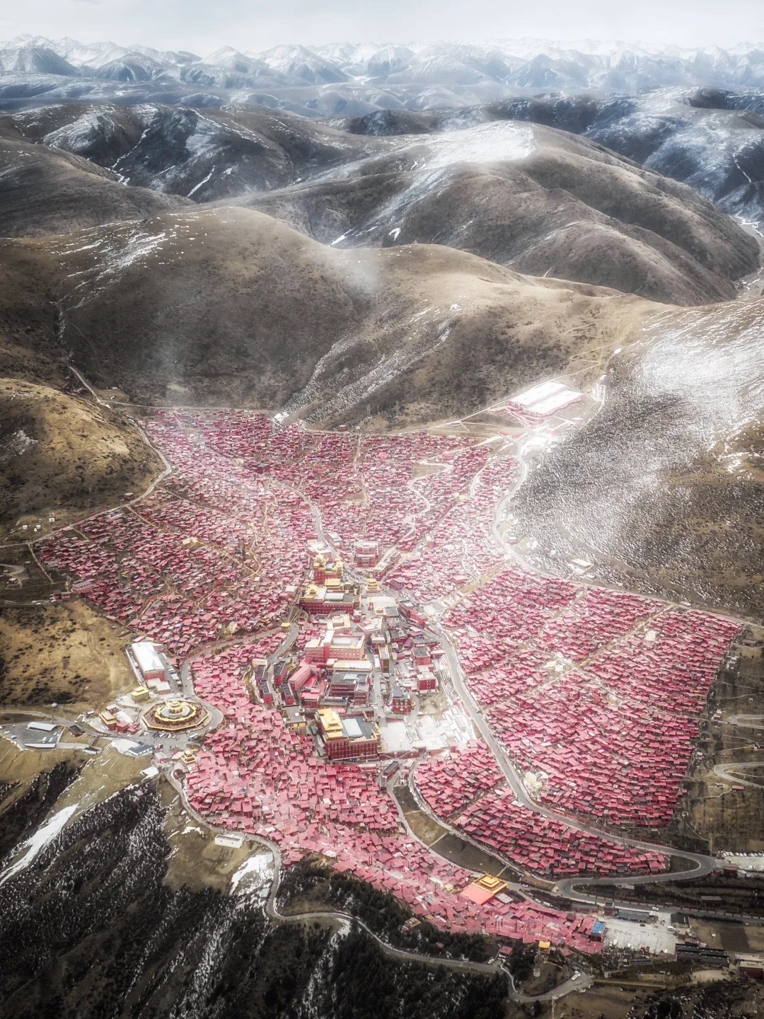
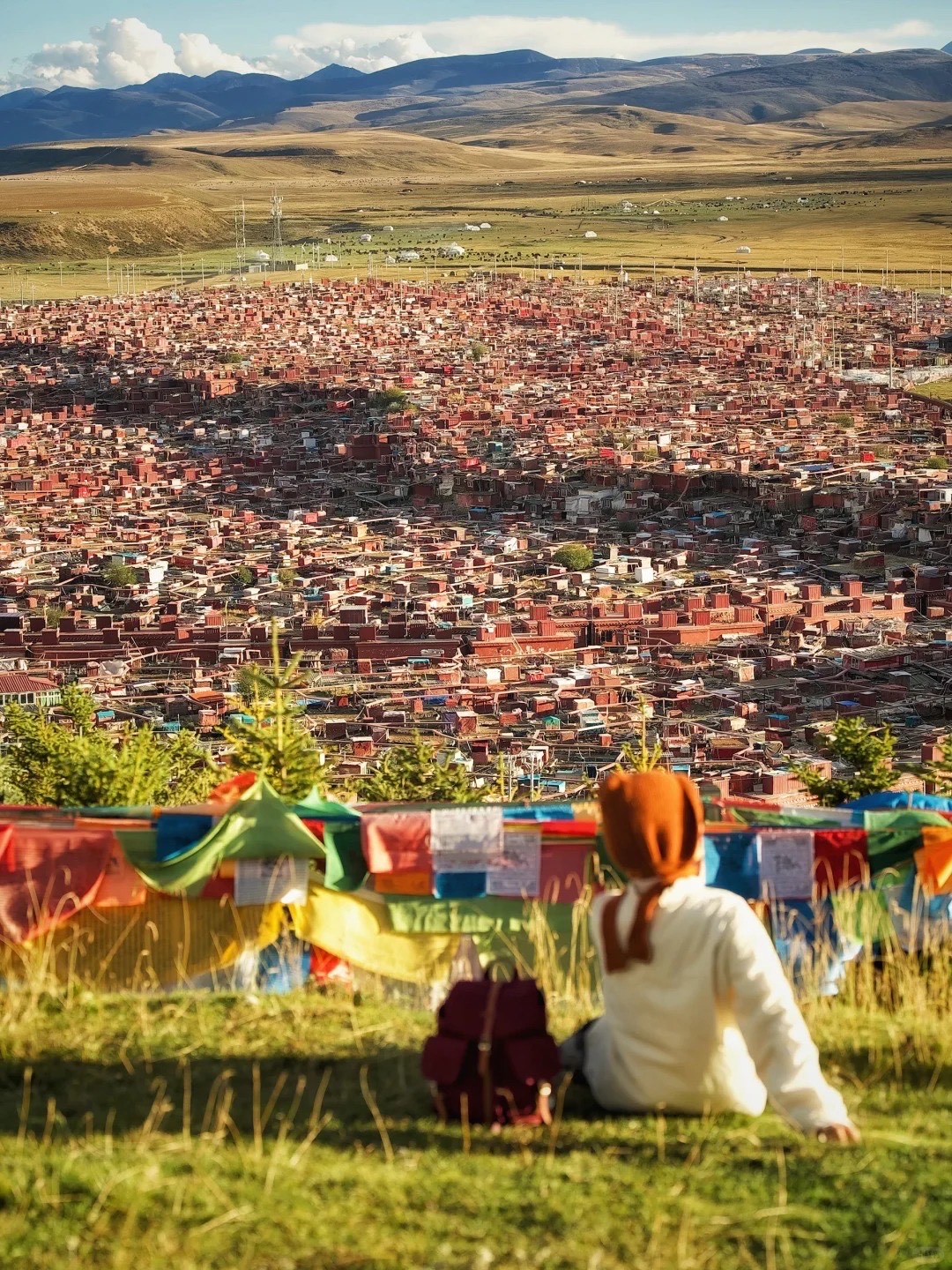
Sertar (色达) is home to Larung Gar, one of the largest Tibetan Buddhist institutes in the world — a sea of red monk dwellings covering an entire valley at around 4,000 metres. It is unlike anything else on earth. A visitor permit is currently required for international travellers. Permits need to be arranged in advance, and the rules change — go with someone who knows the current situation on the ground. Don’t turn up without checking.
Yaqing Temple (亚青寺) is less visited than Sertar and, in some ways, more remarkable and doesn’t require a permit — the female practitioners’ community is extraordinarily photogenic and culturally distinct. Zhugqing Temple (竹庆寺) and Kathok Monastery, Baiyu (白玉县噶陀寺) are significant for travellers with a serious interest in Tibetan Buddhism. Local and international visitors rarely get to these spots.
These are living communities, not attractions. That distinction matters in how you approach them.
The Drives: Where the Road Is the Destination
In West Sichuan, getting there is genuinely half the point. The road network across Ganzi Prefecture covers some of the most dramatic terrain in Asia, and several of its best routes are completely unknown to English-speaking travellers. Here’s what the drives actually are.
G318 (Sichuan-Tibet Highway, Southern Route) is the most storied road in China. Running southwest from Chengdu through the heart of Ganzi toward Lhasa, it crosses passes above 4,700 metres and delivers a sustained sequence of high-altitude scenery that builds for hours. Photographers, cyclists, and serious travellers talk about this road for years afterwards. It earns that.
Lixiao Road connects Lixian and Xiaojin counties through the Siguniang mountain area — a drive of deep gorges, glacial valleys, and near-total solitude. Favourite for local travellers, rarely visited by international travellers.
Ganbai Road runs through the central-western plateau of Ganzi. The grasslands on this route are vast in a way that recalibrates your sense of scale. The sky is enormous. The silence between villages is the kind you remember.
Seluo Road cuts through remote terrain in southern Ganzi and is one of the most photogenic drives in the region — particularly in autumn, when the golden meadows sit against snow peaks in a way that looks like a painting that hasn’t been painted yet.
Dandao Secret Route is exactly what it sounds like. Known primarily within the local guide community. Its precise details are best shared in person, with someone who actually drives it.
Ge Nie South Route approaches the Genie peak from the south and gives you an entirely different perspective on the mountain and its glacial lake — wider, more open, and in our view the better drive of the two approaches.
Every one of these routes rewards the traveller who isn’t in a hurry. The light changes constantly. Yak herds move across open grassland. The road occasionally disappears into cloud, and the view at the next clear moment is better than the last. None of them are routes for rental-car tourists without local knowledge — road conditions change, weather closures are sudden, and at sustained altitudes above 4,000 metres, getting it wrong has real consequences. Drive them with a guide who knows which passes to cross at what time of day, and when to stop.
Practical: What You Need to Know
Getting There
Chengdu is your gateway — two international airports, direct long-haul connections from Sydney and Melbourne via hub cities (Hong Kong, Guangzhou, Shanghai).
When to Go
Aba (Jiuzhaigou, Siguniang, Huanglong): Late September to mid-October for autumn colour. Summer (June–August) is green and accessible. Rainy season (July–August) brings some road instability — check conditions before setting out.
Ganzi (Yading, Genie, scenic drives): Late September to October is peak. Spring (April–May) for wildflowers at Yading and fewer crowds. Most high-altitude roads and park areas close from November through March.
Altitude — Don’t Underestimate It
Large parts of West Sichuan sit between 3,500 and 4,500 metres. Altitude sickness is real here regardless of fitness — an experienced marathon runner can be floored just as easily as a first-time traveller. The rule is simple: ascend gradually, build in slow days at key elevation points, stay hydrated, don’t push it.
Flying directly into Daocheng Airport (4,411m) is the fastest way to get altitude sickness. Driving from Chengdu over two to three days is the most sensible approach for most people. A smartwatch tracking blood oxygen is worth having.
Road Closures
Rainy season (roughly June–September) brings rockslides and sudden closures across parts of Ganzi. Check AMap and confirm with locals before driving — conditions can change overnight. A guide with current road knowledge is not a luxury here.
Permits for Sertar (色达)
Larung Gar requires a visitor permit for international travellers. Requirements and quotas change. Don’t assume last year’s rules still apply. Arrange in advance through a licensed operator.
The Map You Actually Need
Most West Sichuan maps show the main highways and label the UNESCO sites. They leave out the unmarked turnoffs, the viewpoints only locals know, the right time of day to arrive at each location given where the sun sits relative to the mountains, and the guesthouses that are genuinely comfortable versus the ones that appear first in search results.
We’re producing the first English-language insider map of West Sichuan — built on the knowledge of guides who live and drive these routes. It will be available here soon.
Do You Need a Guide?
More than anywhere else we work, yes.
In Yunnan, a guide enriches the experience. In West Sichuan, a guide is also a practical necessity for many travellers. High altitude, remote roads, rapidly changing weather, permit requirements, and Tibetan-language signage on unmarked tracks create conditions where local knowledge directly affects safety — not just quality.
The travellers who get the most out of West Sichuan are those who stop trying to run it from a generic itinerary and let someone who drives these roads every week build something that fits them.
Ready to Plan?
West Sichuan rewards the traveller who goes properly prepared — the right timing, the right route, the right altitude plan, and someone who knows the difference between an ordinary view and one that stays with you for life.
Talk to us about planning your West Sichuan trip →
Our West Sichuan Sky Road itinerary covers the full G318 arc from Chengdu to Daocheng Yading — 10–14 days designed around the altitude, the seasons, and the roads that matter.